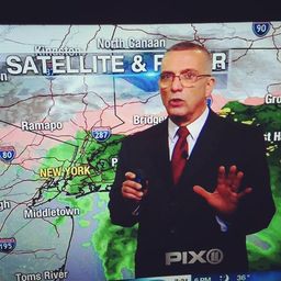
BRISK START TO THE WEEK, NO MORE RAIN UNTIL FRIDAY
Good morning! Hoping everyone had a great weekend and stayed dry.
Roads are still slick this morning and there is some drizzle out there. but any significant rain has ended.
Skies will remain cloudy for the time being, but gradually give way to some sun throughout the day. Temperatures actually remain a few degrees above normal today, but as winds pick up during the afternoon it will start to feel colder. Tonight, falling temperatures and blustery conditions will give yield wind chills in the 20s. It will feel frigid tomorrow morning so be prepared to bundle up and warm up the car!

Tuesday is likely to be the coldest of the week, in the upper 30s. There will be plenty of sunshine the next few days, with temperatures moderating to seasonable levels. Even with more clouds on Thursday it remains dry. A rain storm moves in for Friday, which is really the only day precipitation is expected this week. Friday evening marks the official beginning of the astronomical winter season, but it sure won't feel like it. Temperatures in the 50s are expected throughout the day. Dry and chillier weather returns for the weekend.

WHITE CHRISTMAS WATCH
Current Probability: 15%
Current Probability: 15%
I upped the percentage 5% from yesterday. While most of the long-term models keep it cold but quiet, the Euro is now showing a weak shortwave bringing a few inches of snow to the area on Christmas Eve. I don't see this being anything more than a minor event, if anything. There is a lack or northern stream energy that could perhaps amplify this system. Now, the official definition of a white Christmas is "1 inch of snow on the ground during December 25th". The snow does not have to fall on Christmas Day. So there is certainly some hope this morning for the dreamers out there! --Geoff
Make sure to follow Meteorologists Geoff Bansen and Joe Cioffi on social media!
Geoff: Facebook Twitter Instagram Joe: Facebook Twitter Instagram
And don't forget to bookmark weatherlongisland.com!
Posted from my blog with SteemPress : https://www.weatherlongisland.com/brisk-start-to-the-week-no-more-rain-until-friday/
Leave BRISK START TO THE WEEK, NO MORE RAIN UNTIL FRIDAY to:
Best Posts From joewxman
We have not curated any of joewxman's posts yet. But you can encourage our curation team to review posts by visiting them regularly and by referring other readers. Because we give priority to frequently read content.
More Posts From joewxman
- Winter Storm Watch Long Island Sunday Night Into Tuesday At Least 6 to 10 Inches Forecast
- Winter Storm Watches Posted Preliminary Snow Potential Discussed
- Frigid Day Today Classic Setup Classic Questions Early Week
- NYC Very Cold Air Moving In Tomorrow Through Saturday
- Weak System Pushes Across Today Bringing Wintry Mix
- NYC Light Snow Sleet Freezing Rain & Rain Expected Tomorrow
- Cold Abates Snow Late Monday Night Tuesday Should Not Amount to Much
- NYC Cold Breezy Day Today Plus Tuesday's System Comes Into Better Focus
- NYC Cold Air Arrives & Tuesday's System Remains Unimpressive
- Cold Air Arrives Tonight Questions Remain For Early Week