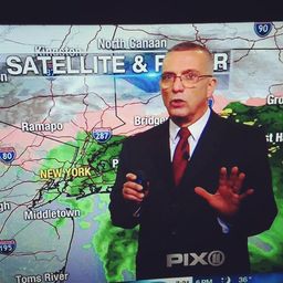
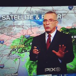
ARCTIC FRONT GENERATED SNOW SQUALLS POSSIBLE TODAY
DOWNLOAD MY NEW FREE JOESTRADAMUS WEATHER APP FOR ANDROID
(Unsupported https://www.facebook.com/plugins/post.php?href=https%3A%2F%2Fwww.facebook.com%2Fmeteorologistjoecioffi%2Fposts%2F10161417866420387&width=500)
ARCTIC FRONT GENERATED SNOW SQUALLS POSSIBLE TODAY
Good morning everyone. That much-talked-about arctic front is heading our way this afternoon, possibly touching off a line of very heavy snow squalls in parts of the area. Along with it, the frigid air will be arriving shortly thereafter.


After a clear morning, clouds will begin to increase as our arctic front nears the area. We'll be keeping a close eye on the radar for development of that area of moisture back by the Pittsburgh, PA area. Just as we watch for severe weather in the spring and summer, it'll be very similar as we watch to see if the line expands, gets stronger, and then to see if it makes it here without breaking apart.
IF we do see some action, it'll be very very brief and possibly very heavy. In terms of duration, we're talking 5 to maybe 15-20 minutes max. It'll be heavy enough to give the area a quick coating (if it doesn't blow all over the place) or a touch more if the band is wider and longer in duration. Winds could gust 40-60mph within the squall line, making it seem Blizzard-like for a short time. As far as timing, we'll be watching for it's approach between 3 and 5pm.
After that, temps drop but the wind remains as frigid air sinks in. Highs today will be in the upper 20's to near 30, but then they drop like a rock as we go for 0-5 degrees as lows in the NYC area overnight.

Our frigid morning will translate into a brutal Thursday, with highs in the 10-15 range and a steady breeze keeping wind-chills as low as -15, especially until late morning. We dip back down into the 5-10 degree realm overnight tomorrow, then very slowly recover on Friday.

For Friday, there's a slight chance we may get brushed with some very light snow as a weak disturbance slips to out south very quickly. This area of moisture represents fully modified air as we rise into the low to mid 30's on Saturday, after low 20's on Friday. Sunday is looking like the best day if we keep the wind at bay. Expect sunny skies and highs in the low to mid 40's.
Please note that with regards to any tropical storms or hurricanes, should a storm be threatening, please consult your local National Weather Service office or your local government officials about what action you should be taking to protect life and property.
Posted from my blog with SteemPress : https://www.nycweathernow.com/arctic-front-generated-snow-squalls-possible-today/
Leave ARCTIC FRONT GENERATED SNOW SQUALLS POSSIBLE TODAY to:
Best Posts From joewxman
We have not curated any of joewxman's posts yet. But you can encourage our curation team to review posts by visiting them regularly and by referring other readers. Because we give priority to frequently read content.
More Posts From joewxman
- Winter Storm Watch Long Island Sunday Night Into Tuesday At Least 6 to 10 Inches Forecast
- Winter Storm Watches Posted Preliminary Snow Potential Discussed
- Frigid Day Today Classic Setup Classic Questions Early Week
- NYC Very Cold Air Moving In Tomorrow Through Saturday
- Weak System Pushes Across Today Bringing Wintry Mix
- NYC Light Snow Sleet Freezing Rain & Rain Expected Tomorrow
- Cold Abates Snow Late Monday Night Tuesday Should Not Amount to Much
- NYC Cold Breezy Day Today Plus Tuesday's System Comes Into Better Focus
- NYC Cold Air Arrives & Tuesday's System Remains Unimpressive
- Cold Air Arrives Tonight Questions Remain For Early Week